One map, three lights
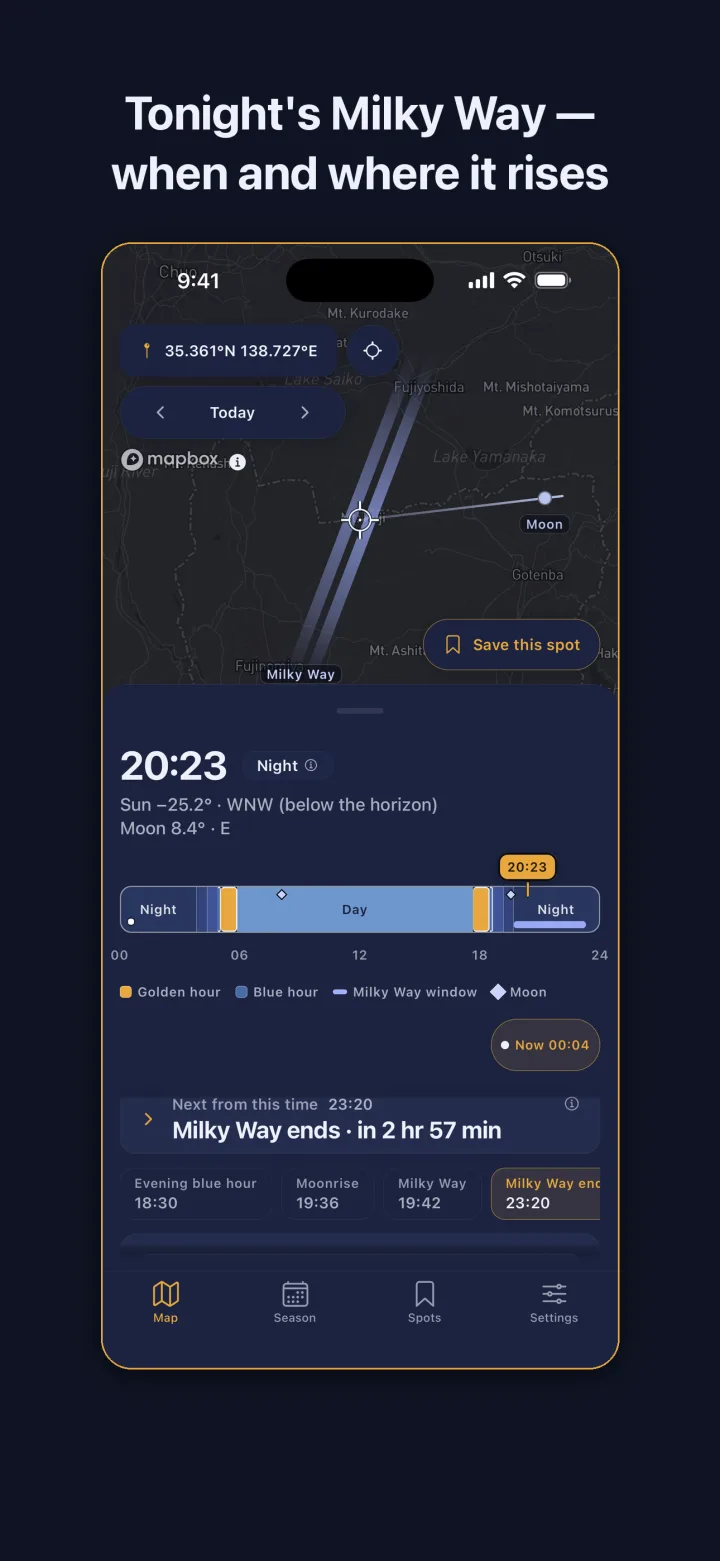
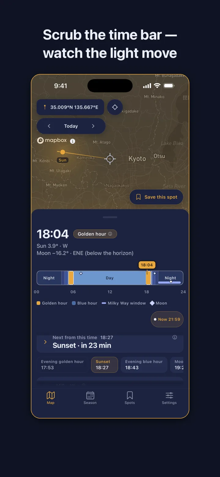
Photographers usually check golden hour in one app, moon phase in another, and Milky Way visibility in a third, then try to line them up in their head. LightTide puts the sun, the moon, and the galactic core on a single map for the point you pick, in that point's local time. Nothing animates on its own: the light moves while your finger moves the time bar, so you run through a whole day of light in a few seconds and stop where it looks right.
The bar is the whole app. Golden hour, blue hour, twilight, and the Milky Way window are stretches on it, and crossing a boundary gives a small haptic tick so you can feel the transitions without looking down at the numbers.
Reading the Milky Way like a tide table
A Milky Way night needs two things to line up: the galactic core has to be above the horizon, and the sky has to be dark enough, meaning astronomical twilight has ended. LightTide computes the overlap and shows it as a window with a start and an end. It also tells you the compass direction and altitude of the core at its highest point, so you know which way to face and how high to frame.
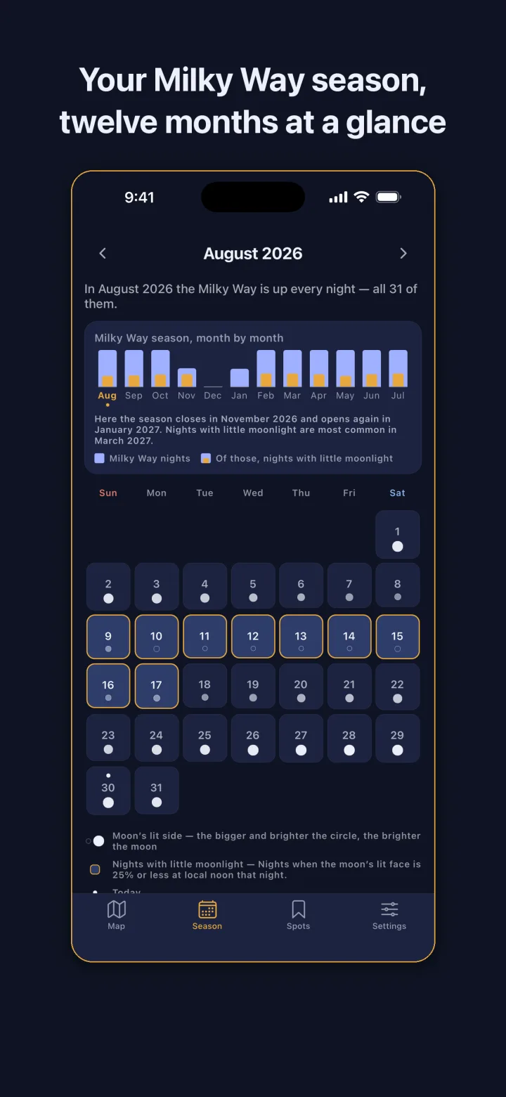
Moonlight is the third factor. The app grades each night as no moonlight, faint moonlight, or strong moonlight based on where the moon sits during the window. The season calendar lays a month out one night at a time so you can pick the dark nights, and the twelve-month view shows how many usable nights each month has for any place on Earth.
Saved spots, alerts, and a Home Screen widget
Save the places you shoot from. Each spot lists today's golden hour and Milky Way window in a single line, so checking your three favorite overlooks takes one scroll. Alerts are optional: one can fire before the evening golden hour, and one before the Milky Way rises, only on nights when it actually will.
A Next Light widget on the Home and Lock Screen shows when the next golden hour, blue hour, or Milky Way window starts, without opening the app.
Checked against published times, with the rules on screen
Positions of the sun, the moon, and the galactic core come from established astronomical algorithms, the NOAA solar equations and Meeus, and are verified against times published by the US Naval Observatory. Definitions vary between sources, for instance where golden hour starts and ends, so every definition the app uses is written out in Settings.
When there is nothing to show, the app says why. White nights with no real darkness, latitudes where the core never rises, and months before the season opens all get a reason and the next chance instead of a blank screen. Clouds and light pollution are not part of the math, so nothing here is promised as visible.
Your coordinates stay on the phone
There is no account, no sign-up, no server of ours, and no analytics SDK. The only network traffic is map tiles, and the map provider's own usage tracking is switched off. Fetching a tile does tell that provider which area you are viewing, which is true of every app that draws a map. Once tiles are cached, the times and saved spots keep working where there is no signal.
Frequently asked questions
Does it work with no signal at the shooting site?
Yes. All calculations run on the phone. Map tiles you have already viewed are cached, so times, windows, and saved spots keep working without a connection.
Does it predict clouds or light pollution?
No. LightTide is a calculator for the sun, the moon, and the galactic core. Weather and light pollution are outside the math, so reading the sky that night is up to you.
How accurate are the times?
Sun, moon, and galactic core positions use the NOAA solar equations and Meeus algorithms and are checked against times published by the US Naval Observatory. The definitions the app uses are listed in Settings.
Why does it say there is no Milky Way tonight?
Either the core is below the horizon at your latitude, the sky never gets dark enough, or the season has not started. The app states the reason and the next chance.
Is my location sent anywhere?
Not to us. There is no account and no server of ours. The map provider sees which area's tiles you request, as with any map app, and its usage tracking is turned off in LightTide.